Tides for Kiters: Spring, Neap, and Low-Tide No-Gos
How spring and neap tides shift session windows, why low tide kills certain spots, and how tidal range turns the same beach into two different places.
The forecast says 18 knots at 14:00. You drive an hour, rig your 9 m, and walk down to the water — except there isn’t any. A hundred meters of exposed mud, a shore-break sucking back over rock, and a launch zone that’s gone home for the next three hours. The wind was right. The tide wasn’t.
On most coasts, tides decide whether a wind forecast turns into a session or a long walk back to the car. If you ride a lagoon, an estuary, or any spot with more than a meter or two of vertical range, ignoring the tide is the most expensive forecasting mistake you can make. Here’s how the cycle works, what spring and neap do to your home break, and which conditions silently kill a spot at low water.
What spring and neap tides are
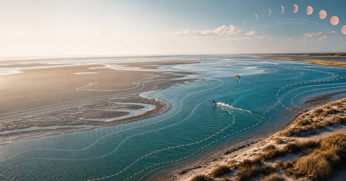
Tides are the ocean responding to gravity from the moon and, to a smaller degree, the sun. The moon’s pull stretches the water envelope around the Earth into a slight ellipse; as the planet rotates inside that envelope, each point on the coast passes through two highs and two lows in roughly 24 h 50 min — a semi-diurnal cycle.
Twice a month, at new moon and full moon, the sun and moon line up. Their gravitational pulls stack, and the resulting spring tides are the largest of the cycle — higher highs, lower lows. The name has nothing to do with the season; it’s from “spring forth.”
Twice between those alignments, at first and last quarter, the sun and moon pull at right angles. They partially cancel. The result is neap tides — smaller highs, smaller lows, less water moving in total.
A full cycle from one spring to the next is about 14.77 days. The biggest springs of the year fall around the equinoxes in March and September, when the Earth–sun geometry adds a final boost.
How a tide cycle shapes a session
Even when the wind is identical for six hours, a spot can switch character three times. Here’s the rough arc on a spot with 4–6 m of range:
| Phase | Water level | What changes |
|---|---|---|
| High water | Peak depth | Reefs and bars covered, dry beach narrowest, choppier surface |
| First 2 h of ebb | Falling fast | Current accelerates seaward, banks start to show, beach widens |
| Low water | Trough | Sandbars, weed, rocks exposed; in lagoons the rideable area collapses |
| First 2 h of flood | Rising fast | Current pushes inland, water returns over warm sand |
| Mid-flood | ~50 % filled | Often the best session window — enough water, manageable current, beach still usable |
The exact timing varies, but the principle holds everywhere: water moves fastest 2–3 hours either side of low tide, slowest at the turn.
Why low tide kills some spots
Low water doesn’t only mean less water. On certain spots it removes the spot entirely. The common failure modes:
- Exposed reef or rock — what was a flat-water playground at high tide becomes a dry obstacle course
- Sandbars beach out — the surf line moves 200 m offshore and you can’t reach it without an upwind walk
- Lagoon inlet drains — narrow channel becomes too shallow to launch a kite or to wade safely
- Tidal current ramps up — in narrow gaps, mid-ebb current hits 2–4 kt and pushes you downwind faster than you can ride back
- Shore break on rock — instead of sand to crash into, you get whatever the sea has uncovered
- Weed beds surface — what your fins glide over at high tide wraps around them at low
- Wind shadow grows — low water moves the waterline farther from the dune or cliff, but the cliff height stays the same, so the dirty-air zone gets proportionally bigger
Most of these are spot-specific. The point is to know which ones apply to your spot before you commit to the drive.
Wind against tide — the chop multiplier
Tidal current matters even when depth doesn’t. Where the tide moves a meaningful body of water — estuaries, inlets, channels between islands — the surface acts very differently depending on whether wind and current agree or fight.
- Wind with tide: current carries water the same direction the wind is pushing it. The surface stays relatively smooth; chop is lower than the wind speed would predict.
- Wind against tide: current pulls one way while wind pushes the other. Waves stack up short and steep, often doubling in height for the same wind. Familiar to anyone who has ridden the Solent on a spring ebb.
Spring ebbs amplify both effects. Neaps soften both. The same 18 kt session on a neap can be noticeably choppier on a spring with wind against tide.
Reading your spot — checklist
Before you trust a forecast, run the tide check:
- What’s the tidal range on this date — spring, neap, or in between?
- What are high and low water in local time, and do they fall inside the wind window?
- Does the spot need a minimum depth (reef, sandbar, weed)?
- Is the inlet or channel safe to cross at both highs and lows?
- Will the current direction help or fight the wind?
- For sea-breeze afternoons (see Sea Breeze 101) — does the breeze peak with rising or falling water?
If the answer to any of those is I’m not sure, the tide table answers it in 30 seconds. The 30 seconds you skip are the ones that lose you a session.
Where tide rules the session
A few spots where tide is the lead actor, not the supporting one:
- Óbidos lagoon, Portugal — the inlet is narrow and shallow. Spring lows drain so much of the flat area that the rideable surface contracts to half its high-tide footprint. Mid-flood with the prevailing Nortada is the sweet spot.
- Aveiro lagoon (Ria de Aveiro), Portugal — a network of tidal channels. The lagoon is huge, but most of it goes ankle-deep at low water on a spring. Time it wrong and the chop becomes mud.
- Wissant, France — spring range of 6–8 m. At low water the wadeable flat extends hundreds of meters out; at high water there’s barely a beach to set up on.
- Rømø, Denmark — the Wadden Sea side is one of the largest tidal flat systems in Europe. A spring low leaves kilometers of exposed sand. Local riders read the schedule the way a windsurfer reads a wind forecast.
- Hayling Island, UK — Solent currents combine with shallow banks. Spring ebbs with a southwesterly produce textbook wind-against-tide chop; the same wind on a flood is a different sport.
- Dakhla lagoon, Morocco — often sold as flat-water year-round, but the area near the lagoon entrance shifts in width and depth with the tide. Spring lows turn the upper lagoon into a wade.
Frequently Asked Questions
How often do spring tides happen?
Twice every lunar month — within a day or two of every new moon and every full moon. A full cycle from one spring to the next is about 14.77 days.
Does the Mediterranean have tides?
Yes, but small. Most of the Med sits at 20–40 cm of range, which for riding purposes is effectively no tide. The exceptions are the northern Adriatic (Venice can see ~1 m) and the Gulf of Gabès in Tunisia.
Why is low tide sometimes the best time to ride?
On spots where a sandbar produces flat water just inside its lip, low water uncovers the bar and creates a sheltered slick downwind of it. Some Atlantic sandbar spots work this way — the bar has to be exposed to do its job.
What is wind against tide and is it dangerous?
It’s wind blowing against the tidal current. Waves stack up shorter and steeper than the wind alone would build, and the current can push a downed rider seaward fast. Not inherently dangerous, but plan a self-rescue line that accounts for current, not just wind.
How do I find tide data for my spot?
National hydrographic offices (SHOM in France, UKHO in the UK, NOAA in the US, IH in Portugal) publish free tide tables. Most marine forecast apps show a tide curve for the nearest reference port.
Do tides matter for foiling?
They matter more for a foil than for a fin, not less. A foil mast hangs 60–90 cm below the board, so shallow sandbars and weed beds that a twintip happily skims over will stop a foil cold — and you go over the front. The upside: once you’re up and flying, wind-against-tide chop is friendlier on a foil, because you’re above it.
How Wavind helps
Wind without tide is half the picture on any spot with real range. Wavind shows the tide curve next to the multi-model wind view, so you can read GFS, ICON, and AROME against a rising or falling water level instead of in isolation. When ICON predicts 18 kt at 16:00 and the tide table puts low water at 16:20, you catch the conflict before you load the car.
We also let you tell each spot what its good tide window is. Per-spot acceptable tide ranges feed into the session score — so a forecast that’s perfect on paper but lands on a low spring at your reef break drops out of the green automatically. Your spot, your rules, scored against every hour of the cycle.
Want sessions scored against tide, not just wind? Join the Wavind beta and get early access.